이전
다음
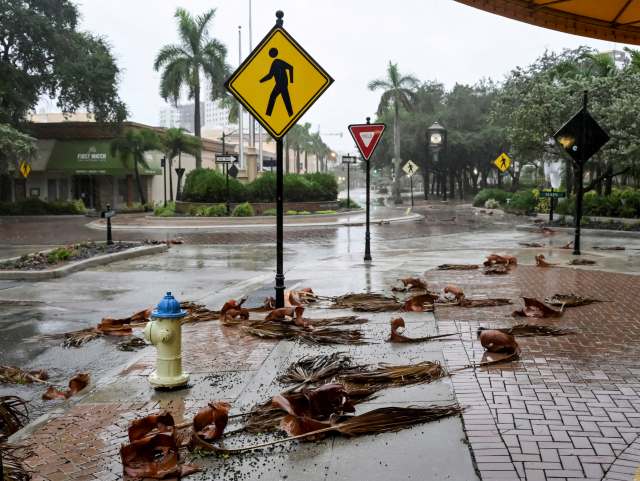 FILE PHOTO: Downed palm fronds collect on an empty downtown intersection as Hurricane Ian approaches Florida?s Gulf Coast in Sarasota, Florida, U.S. September 28, 2022. REUTERS/Steve Nesius/File Photo
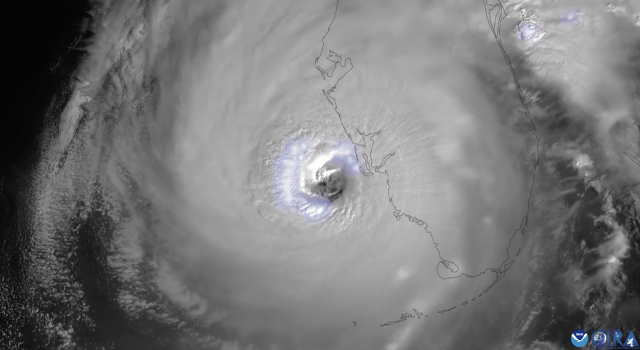 This National Oceanic and Atmospheric Administration (NOAA) satellite handout image shows lightning surrounding Hurricane Ian\'s eye while approaching Florida, on September 28, 2022 at 15h13 UTC. - Heavy winds and rain pummelled Florida on Wednesday as Hurricane Ian intensified to just shy of the strongest Category 5 level, threatening to wreak \"catastrophic\" destruction on the southern US state. Forecasters warned of a looming once-in-a-generation calamity, with life-threatening storm surges, extensive flooding and devastating winds promising what Florida Governor Ron DeSantis called a \"nasty\" natural disaster. (Photo by Handout / NOAA/RAMMB / AFP) / RESTRICTED TO EDITORIAL USE - MANDATORY CREDIT \"AFP PHOTO / NOAA/RAMMB\" - NO MARKETING NO ADVERTISING CAMPAIGNS - DISTRIBUTED AS A SERVICE TO CLIENTS
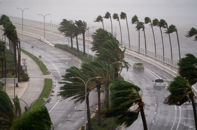 SARASOTA, FL - SEPTEMBER 28: Motorists travel across the John Ringling Causeway as Hurricane Ian churns to the south on September 28, 2022 in Sarasota, Florida. The storm made a U.S. landfall at Cayo Costa, Florida this afternoon as a Category 4 hurricane with wind speeds over 140 miles per hour in some areas. Sean Rayford/Getty Images/AFP
FILE PHOTO: Downed palm fronds collect on an empty downtown intersection as Hurricane Ian approaches Florida?s Gulf Coast in Sarasota, Florida, U.S. September 28, 2022. REUTERS/Steve Nesius/File Photo
This National Oceanic and Atmospheric Administration (NOAA) satellite handout image shows lightning surrounding Hurricane Ian\'s eye while approaching Florida, on September 28, 2022 at 15h13 UTC. - Heavy winds and rain pummelled Florida on Wednesday as Hurricane Ian intensified to just shy of the strongest Category 5 level, threatening to wreak \"catastrophic\" destruction on the southern US state. Forecasters warned of a looming once-in-a-generation calamity, with life-threatening storm surges, extensive flooding and devastating winds promising what Florida Governor Ron DeSantis called a \"nasty\" natural disaster. (Photo by Handout / NOAA/RAMMB / AFP) / RESTRICTED TO EDITORIAL USE - MANDATORY CREDIT \"AFP PHOTO / NOAA/RAMMB\" - NO MARKETING NO ADVERTISING CAMPAIGNS - DISTRIBUTED AS A SERVICE TO CLIENTS
SARASOTA, FL - SEPTEMBER 28: Motorists travel across the John Ringling Causeway as Hurricane Ian churns to the south on September 28, 2022 in Sarasota, Florida. The storm made a U.S. landfall at Cayo Costa, Florida this afternoon as a Category 4 hurricane with wind speeds over 140 miles per hour in some areas. Sean Rayford/Getty Images/AFP